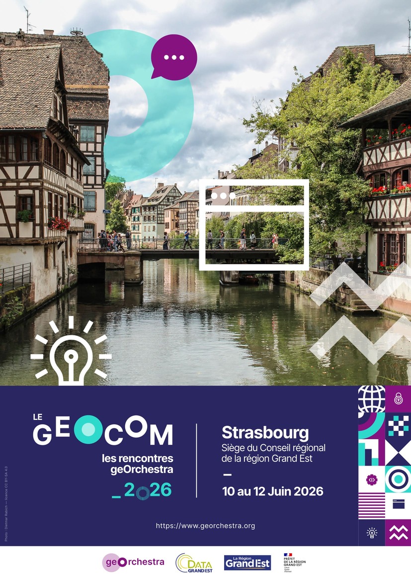
The PSC is pleased to announce that the 13th edition of geOcom, the annual meeting of geOrchestra users and developers, will take place from June 10 to 12, 2026 in Strasbourg at the invitation of DataGrandEst.
It will be preceded by a community sprint on June 8, 9, and 10
held at the Shadok, 25 presqu'île André Malraux, Rue du Bass. d'Austerlitz, Strasbourg.
© PSC geOrchestra
Where?
Headquarters of the Grand Est Regional Council
1 place Adrien Zeller, Strasbourg
Register
Registration is closed.
Programme
Wednesday, June 10
| 13:00 | Welcome of participants | ||
| 13:30 | Ice Breaker | ||
| 14:00 | Introduction to geOrchestra: values and community organisation | PSC geOrchestra | |
| 14:20 | Discovering geOrchestra through the testimonials of DataGrandEst partners |
An interactive, multi-voice presentation in 3 parts. The goal is to present geOrchestra in an accessible, coherent and concrete way — its strengths for public organisations and the key steps to get started — primarily aimed at newcomers and curious attendees, stepping back to look at data and its uses. Eurométropole de Strasbourg: why hasn't the Eurométropole de Strasbourg adopted geOrchestra yet? Local feedback: CeA and GéoRhéna Taking action: how to adopt geOrchestra? by ADEUS / Région Grand Est |
Olivier BANASZAK, Jean-Pascal KLIPFEL - EuroMétropole de Strasbourg. Boris STERN, Laetitia HORNY, Stéphane RITZENTHALER - CeA et GeoRhena. Pierre de CADENET, Guillaume RYCKELYNCK - ADEUS / Région Grand Est. |
| 15:15 | Platform showcase | the community | |
| 16:00 | What's New | ||
| Towards a more autonomous mviewerStudio: user data and advanced styling | The overall goal of these 2 improvements is to increase user autonomy. The first concerns importing personal data. It addresses a recurring user need identified on Santégraphie: enabling users to map their own data from a spreadsheet and update their maps independently. |
Oscar JANIN - Santégraphie Gaëtan BRUEL - JDEV |
|
| GeoServer 3 |
What changes should we expect in geOrchestra for this major version? Identifying key evolutions and their impact on our platforms. |
Pierre MAUDUIT - Camptocamp | |
| Break | |||
| 17:15 | Use Cases | ||
| Sovereign immersive imagery in my SDI | Panoramax is a free alternative to Streetview and Mapillary, designed in federated mode. Each SDI can integrate its own Panoramax instance at low cost, allow its users to contribute with simple tools, consume its own immersive views within the SDI, and share them with the community. | Landry BREUIL - CRAIG | |
| Where are we heading? | How to navigate effectively between INSPIRE, Open Data, Closed Data and Data Commons? | François VAN DER BIEST - Camptocamp | |
Thursday, June 11
| 09:00 | Artificial intelligence in our platforms | ||
| AI and MviewerStudio | Create and deploy your mviewer maps using MCP Server. | Pierre JEGO - JDEV | |
| Agentic AI for (geospatial) data | LLMs and generative AI are reshaping what our data platforms can offer to their users. This presentation explores how agentic AI addresses two long-standing challenges: finding the right data, and using it to produce meaningful answers for decision-makers. We will walk through the technical building blocks — embeddings, semantic search, knowledge graphs — and then the agentic workflows that orchestrate them. Finally, a state of the art of geo-LLMs: where do we stand on geographic data, and what remains to be built? | Florent GRAVIN - Camptocamp | |
| An MCP in your geOrchestra platform | The explosion of LLMs has us used to conversing with the Web. What if this opportunity extended to our geOrchestra platform? Thanks to the MCP standard, we will see how we can, through our favourite AI agent, talk directly to our data and our platform. We will explain the principles behind this standard, show concrete applications for discovering and exploiting geographic data, and discuss the approach and questions to consider when bringing this technology to geOrchestra. | Florent GRAVIN - Camptocamp | |
| Will AI destroy geOrchestra? | With AI agents now able to code on your behalf, what is the human's place? AI for better or for worse? What safeguards? What adaptations? | François VAN DER BIEST - Camptocamp | |
| AI & observability: diagnosing performance and issues in geospatial software | We will show how we connected Claude to application logs from a platform with metrics (Prometheus) via MCP. | Émilien DEVOS - Camptocamp | |
| Break | |||
| 10:30 | Data producers | ||
| Datafeeder 2.0: the central module for managing your data | DataFeeder addresses a core need: enabling users to load data into the geOrchestra platform. This new version adds the features that were missing from the first: more supported formats, remote sources, metadata editing, access rights management, and the ability to define ingestion recurrence. | Laure-Hélène BRUNETON - Camptocamp | |
| Datafeeder 2.0 is back! | The geOrchestra suite gains a new data ingestion module — Datafeeder 2. It diversifies the input data formats for the platform, with improved rights management and easier updates. I want to hear from the audience and involve participants to gather needs and wishes in order to quickly drive further evolutions and enhancements. | Florent BERAULT - Lille Métropole | |
| Mastering the full data lifecycle with geOrchestra | The aim of this talk is to (de)monstrate that the various geOrchestra modules cover all stages of the data lifecycle: collection (geocontrib or others), cataloguing (ingestion module / metadata editor), dissemination (datahub) and above all valorisation (Superset and MapStore). Illustrated through various public policy use cases (mobility, quality of life, cycling — both GEO and NON-GEO data), while highlighting some limitations and areas for improvement. | Florent BERAULT - Lille Métropole | |
| 11:30 | OpenData4Growth - presentation and discussions | ||
| OD4GROWTH: Open Data to support local growth and urban transformation | OD4GROWTH is a project that aims at working on this track: triggering the quality and quantity of data from one side, enhancing well-being and citizens quality of life with better public services, new applications and new products. | Guillaume RYCKELYNCK - Région Grand Est | |
| Break | |||
| 13:30 | Public users and service creators | ||
| geOrchestra x QGIS: how far does interoperability and modularity go? | We will present the QGIS proof of concept and discuss a proposal for a "geOrchestra light" version based on MViewer and QGIS Server. |
Jean-Michel CREPEL - Camptocamp Gaëtan BRUEL - JDEV |
|
| geOrchestra 26 | Presentation of new features and improvements. | Florian NECAS - Camptocamp | |
| MapStore at geOcom 2026: A Year in Review | The presentation will showcase the latest additions in 2025.02.00-geOrchestra as well as ongoing works and plans for MapStore in 2026. | Tobia di PISA - Geosolutions | |
| sviewer: the return |
"sviewer, one dataset is enough". A very simple, accessible and fast viewer to build and instantly share a single-dataset app. Grist widget for data entry. |
Fabrice PHUNG - DREAL Bretagne | |
| Updating data in MapStore | Updating attribute data in MapStore, with a simple plugin and an improved user interface. | Vincent FABRY - Région Hauts de France | |
| Mapping in a Superset dashboard | Development of a mapping plugin for integration into a Superset dashboard. | Nicolas ROCHARD - Région Hauts de France | |
| Break | |||
| 15:30 | Platform administrators | ||
| State of gaia |
Progress on gaia since the geOcom 2025 presentation: - GeoServer datadir - GeoNetwork datadir - mviewer - Docker support |
Landry BREUIL - CRAIG | |
| Analytics: usage statistics for my platform | A tool to measure service consumption on my platform, with nice dataviz, in a single dashboard. | Jean POMMIER - Pi Geosolutions | |
| An orchestrator in geOrchestra: publishing external data with Kestra | Fetching data from outside the platform, processing it in every direction, and publishing it into geOrchestra to exploit it in maps and more. | Jean-Baptiste DESBAS - Région Hauts de France | |
Friday, June 12
| 09:00 | Detailed report on community sprints (Ariège + Strasbourg) | ||
| Where do we stand on the source code reorganisation? | ... | Florian NECAS - Camptocamp | |
| 3 years of geOrchestra Improvement Proposals | A brief summary of the process. | Maël REBOUX - PSC geOrchestra | |
| Security updates and digital accessibility (RGAA) |
Since the latest versions of geOrchestra, significant work has been carried out along two major axes: - strengthening application security - improving digital accessibility (RGAA). |
Pierre JEGO - JDEV | |
| 09:45 | geOrchestra architecture evolutions | ||
| How to reconcile remote authentication (France Connect, Pro Connect, etc.) and private data access via QGIS or other tools? | We will present the need and the proposal for a revocable token manager for secure access to services. | Florian NECAS - Camptocamp | |
| Deploying a production geOrchestra with ease | Have we found the right balance between implementation complexity, effort factorisation and platform availability? A new way to deploy geOrchestra with Docker Swarm. | Jean-Michel CREPEL - Camptocamp | |
| One less SPOF! | We will show how we implemented load balancing on geOrchestra's critical component (Security Proxy or Gateway) to reduce platform downtime and avoid issues such as user session loss during updates. | Florian NECAS - Camptocamp | |
| Break | |||
| 11:00 | Community life | ||
| Joining the GeoServer community | In the style of a "day in the life" testimonial. | Pierre MAUDUIT - Camptocamp | |
| GeoServer + GDAL: it boosts performance. But… | Memory management & raster edge transparency (alpha channel handling): potential solutions, community co-funding effort. | Pierre MAUDUIT - Camptocamp | |
| Funding | Community discussion on cross-funding, co-financing, and related tracks. | everyone | |
This program was translated from the French version at 99% using generative artificial intelligence.