geOcom 2025
Rennes 2025 June 23 24 25
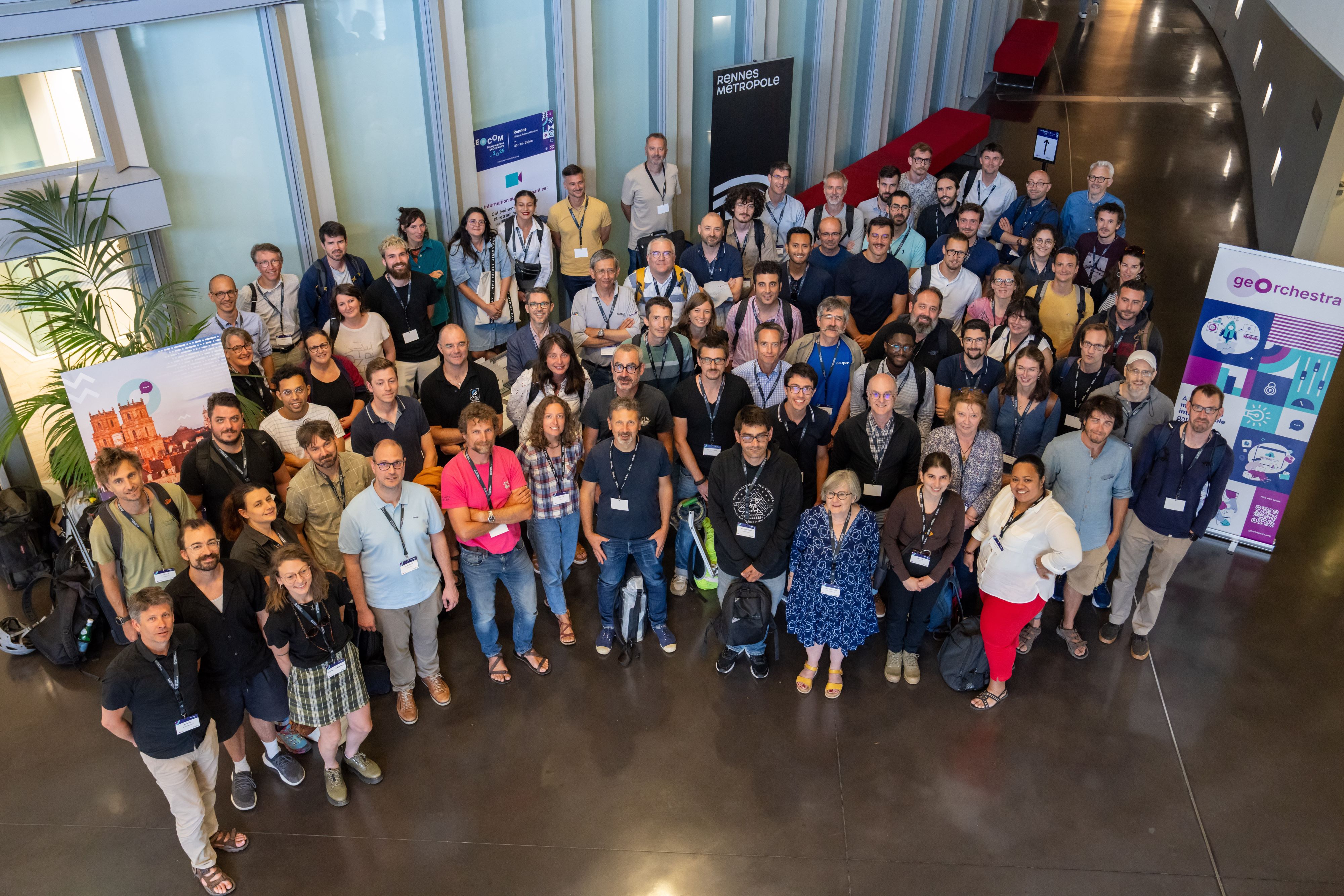
The PSC is pleased to announce that the 12th edition of geOcom, the annual meeting of geOrchestra users and developers, will take place from June 23 to 25, 2025 in Rennes at the headquarters of Rennes Métropole.
It will be followed by a code sprint on June 25, 26, and 27.

© PSC geOrchestra
Where ?
4 avenue Henri Fréville
CS 93111
35031 Rennes Cedex
Register
Participation in this event is free but registration is required, to allow us to welcome you in the best conditions.
Registration form : https://framaforms.org/geocom-2025-1740581616
Program
Monday, June 23
1:30 PM | Welcome | |
2:00 PM | Opening Remarks |
PSC geOrchestra, Yann Huaumé, Vice-President for Digital Affairs, Rennes Métropole |
What is geOrchestra? |
||
2:15 PM | Welcome to the geOrchestra Community | |
2:30 PM | What's New in geOrchestra 25 |
François Van Der Biest & Florian Necas |
3:00 PM |
Platform Showcase |
The Community |
3:15 PM |
Convergence of French Geographic Platforms Review of geOrchestra's Contribution to the Interoperability Collective: OGC API Features & ProConnect |
François Van Der Biest, Pierre Mauduit, Pierre Jégo, Gaetan Bruel |
Meeting Business Needs |
||
3:30 PM |
Meeting Business Needs with geOrchestra How does geOrchestra help us meet the business needs of our services, combining native and customized functionalities? Providing an application for managing DTDICT, offering thematic map models or even adapted environments to facilitate access to business data, enabling the selection and download of oblique aerial photographs of the territory, or facilitating collaboration among stakeholders for PLUi evolutions; all these needs are made possible thanks to the use of geOrchestra components and their integration into the local authority's IT system. |
Philippe Laot, Louise Baillet, Rodolphe Goffinet - Rennes Métropole |
Open Discussion | ||
4:30 PM |
Adoption of geOrchestra by a Consulting Firm Presentation focused on functionality and internal actions (animation, setting up documentation, choices in data to store…) & future perspectives (performance, use cases to deploy…) |
Jérôme Boutet - Biotope |
4:50 PM |
geOrchestra as a Survey Engine Deploying Surveys with geOrchestra and SurveyJS |
Jean-Baptiste Desbas (Géo2France) |
5:05 PM |
Facilitating Collaborative Working Groups in geOrchestra Deploying an eXo Platform within the geOrchestra Environment |
Jean-Baptiste Desbas, Nicolas Rochard, Vincent Fabry - Géo2France |
5:20 PM |
Experience Feedback on NGSI-LD/GeoServer Integration: Predictive Analysis of School Maps Presentation of the work done with Cerema as part of the Fabric’O project to predict and anticipate the number of students per neighborhood for schools dependent on the city, and closely monitor the evolution of population typology in the territory. The platform is based on the NGSI-LD specification and integrates several open-source tools including Twin ·Picks, Stellio, Superset, and GeoServer. |
Franck LE GALL |
Tuesday, June 24
Valuing Data, Maps or Not |
||
9:00 AM |
Superset: Data Visualization in geOrchestra Presentation of the work done aiming at the integration of Superset into geOrchestra. |
Jean Pommier, Nicolas Rochard |
9:20 AM |
Mapping in SuperSet Possible interactions between Superset and mviewer, feedback from GéoBretagne and Geo2France |
Nicolas Rochard, Fabrice Phung |
9:35 AM |
Grist, the No-Code Promise Finally Delivered? Grist promises to be the database for everyone. Is this a realistic promise? For whom? What complementarities with geOrchestra? |
Fabrice Phung, DataEtat startup, Pierre Jégo |
9:50 AM |
MapStore at geOcom 2025: A Year in Review The presentation will showcase the latest additions in 2024.02.00-geOrchestra as well as ongoing works and plans for MapStore in 2025 |
Tobia di Pisa - GeoSolutions |
10:10 AM |
Latest Developments in mviewer Studio The region has funded a number of developments on mviewerstudio in 2024, whether on the frontend (new tree structure, new options, addition of group level...) or backend (facilitation of restart, logs...). The goal would be to present these new features and possibly a demonstration |
Loïc Ecault - Région Bretagne |
Open Discussion | ||
Participating in Data Opening |
||
11:05 AM |
geOrchestra: From IDG to Territorial Data Platform. Roadmap and Feedback from the European Metropolis of Lille. How to move from an open data logic to a secure and shared datahub between actors of the same territory. The challenge of implementing territorial data governance, of which the datahub and its functional capabilities constitute a central tool. |
Florent Berault - European Metropolis of Lille |
11:35 AM |
What Does It Mean Concretely to "Move from an INSPIRE Logic to a DATA Logic" for geOrchestra? Summary |
Florian Necas, François Van Der Biest - CampToCamp |
Lunch | ||
Depositing, Describing, Finding Data |
||
2:00 PM |
Datahub - New Features The datahub (GeoNetwork-UI) is constantly evolving. Major new features are being integrated following exchanges within the community (IGN, geOrchestra, SwissTopo). A new version planned for summer 2025 should thus offer support for service and reuse metadata, the addition of an attribute catalog visualization module, pagination of WFS sources, support for Vector Tiles sources, restoration of a quick access bar, and better support for users on restricted access sources. |
Laure-Hélène Bruneton - CampToCamp |
2:10 PM |
Datahubs by GeoNetwork Sub-Portals User manual, limitations, and applications |
Florent Gravin, François Van Der Biest - CampToCamp |
2:20 PM |
White-Label Portal - What Remains to Be Done? With geonetwork-ui, you can integrate catalog snippets on any site |
To be confirmed |
2:50 PM |
A Bit of Géoplateforme on Your Platforms. The Géoplateforme program chose to use the Datahub for the cartes.gouv.fr catalog interface. Since then, several contributions of various kinds have been made, including: * support for the object catalog (featurecatalog ISO19110), service entrusted to Camptocamp * the module for downloading pre-packaged data distributed by the Géoplateforme |
Xavier Thauvin & Melodia Mohad - IGN |
3:05 PM |
Metadata Editor The metadata editor (GeoNetwork-UI) has been available for production use since early 2025. This tool aims to simplify metadata entry, particularly in an OpenData context. Users are guided through a simple and clear process. The architectural choices of the GN-UI editor (pivot model, interface above APIs) make it compatible with more advanced use within GeoNetwork itself, with metadata editing being non-destructive of existing values. New features will be developed during the year, including multilingual support and templates. |
Laure-Hélène Bruneton - CampToCamp |
3:15 PM |
AI and LLM, Boost the Discoverability of Your Data Applications of LLM in the geospatial world and data platforms, particularly for the geOrchestra platform in the context of creating the DataGrandEst Chatbot. |
Florent Gravin - CampToCamp |
Open Discussion | ||
Manipulating Data |
||
4:05 PM |
How to Feed Your IDG More Easily? Revamping the Datafeeder Module in geOrchestra Data ingestion is one of geOrchestra's weaknesses and needs an overhaul. What are our needs, and what solution should we implement? |
Florian Necas, Florent Berault |
4:25 PM |
Mutual Benefits of Integrating OpenStreetMap Data into geOrchestra Both based on PostgreSQL/PostGIS, OpenStreetMap (OSM) and geOrchestra together offer often overlooked potential. By integrating OSM into geOrchestra, you can access advanced ETL (Extract, Transform, Load) capabilities, create native download points, or benefit from filtering, analysis, and contribution tracking features that are not natively available in OSM web tools. In return, geOrchestra can leverage the richness of OSM data, automatically updated every minute if necessary, to enrich business data or cross-reference it. The presentation will illustrate several concrete examples of these synergies. |
Severin Menard - Les Libres Géographes |
4:45 PM |
Leveraging Open-Source Tools for Creating 3D Tiles in the Urban Environment The presentation covers the processes and open-source tools for building 3D Tiles for urban environments, including 3D data visualizations in MapStore and geOrchestra |
Tobia di Pisa - GeoSolutions |
Wednesday, June 25
Administering the Platform |
||
9:00 AM |
Helm, K8s, geOrchestra, Roadmap Status of the geOrchestra Helm chart and roadmap - concrete implications |
Emilien Devos |
9:20 AM |
GAIA - Making a Le Nôtre Garden of Your Data Infrastructure An overview of a geOrchestra platform, the interlinks between components, and the inconsistencies between the different information provided by the platform. |
Landry Breuil - CRAIG |
9:40 AM |
Maelstro Design your datasets in pre-production, deploy them in a few clicks to your production environment. Maelstro is a tool for synchronizing metadata, layers, and styles between geOrchestra environments |
Jean Michel Crepel - CampToCamp |
10:00 AM |
New Analytics Module for geOrchestra Presentation of the work done as part of GIP 11 |
Jean POMMIER |
Open Discussion | ||
How the Community Works |
||
10:50 AM |
Towards a geOrchestra Design System? The need for unification of the user experience within the various components of geOrchestra raises the question of a shared "design system." We propose to take stock of this issue and collect your feedback on this occasion. |
Pierre Grambert |
11:10 AM |
Modernization of geOrchestra and Data Sharing Unification of geOrchestra applications under a single graphic charter, simplification of the user experience, and sharing of data/metadata on other sites. |
Florian Necas |
11:30 AM |
Developer Community: Do We Need More Processes? Participation in the project, committers, reviews, security incident management, feedback on GIPs… |
Pierre Mauduit |
11:50 AM | Planned Evolutions by the Community, Synthesis of the Geocom | |
Lunch | ||
Community Sprint |
||
2:00 PM | Start of the Community Sprint |